Colorado is a goldmine of America’s most loved trails, parks, peaks, and outdoor adventures. Whether a climber, trailblazer, outdoor enthusiast, or whether you’re relatively new to all of the hype, Colorado has countless reasons to get you excited! With a year-round opportunities for exploring the outdoors, hiking in Colorado is always a good idea. Start planning for your next hikes in Colorado here!
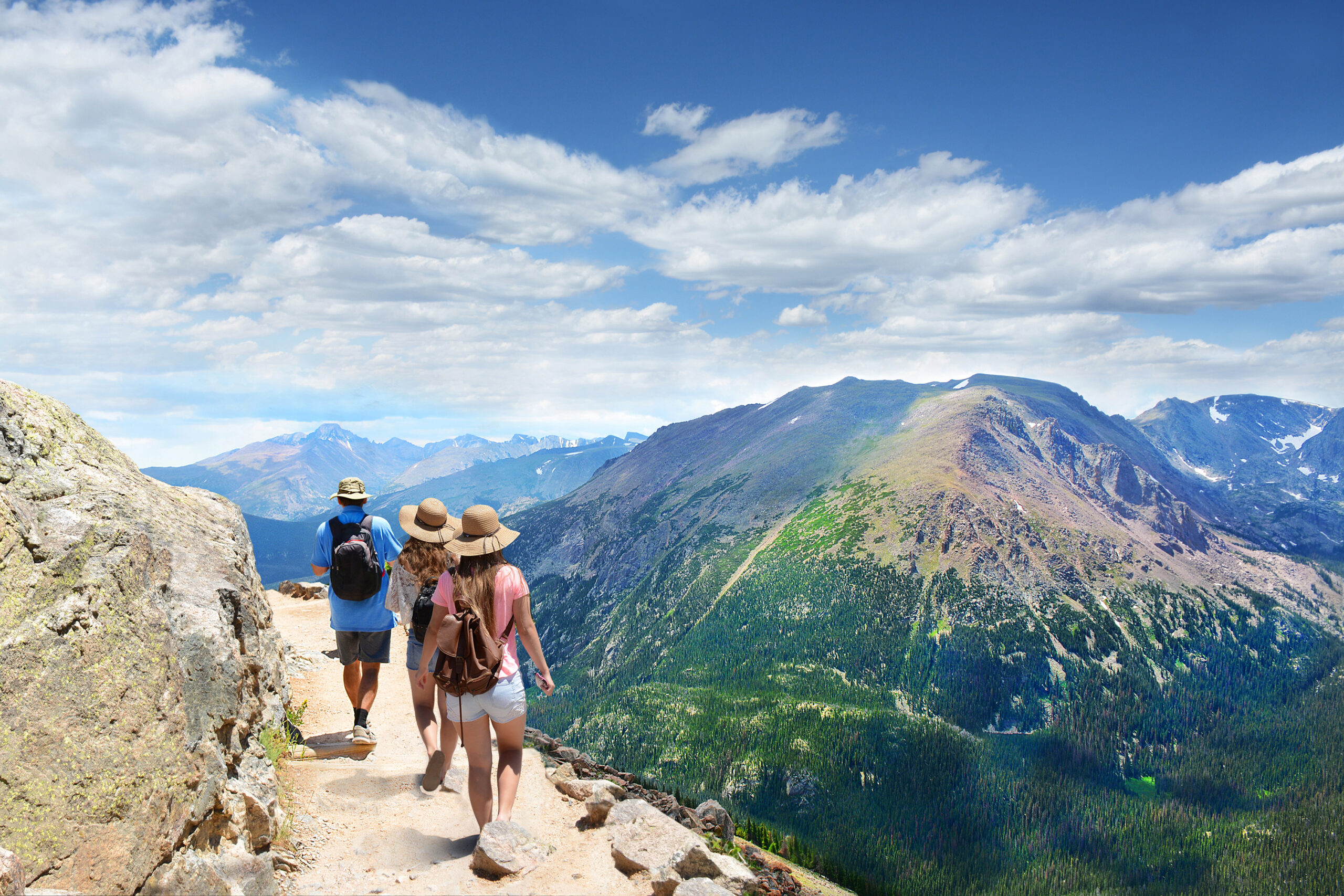
16 Most Scenic Hikes in Colorado
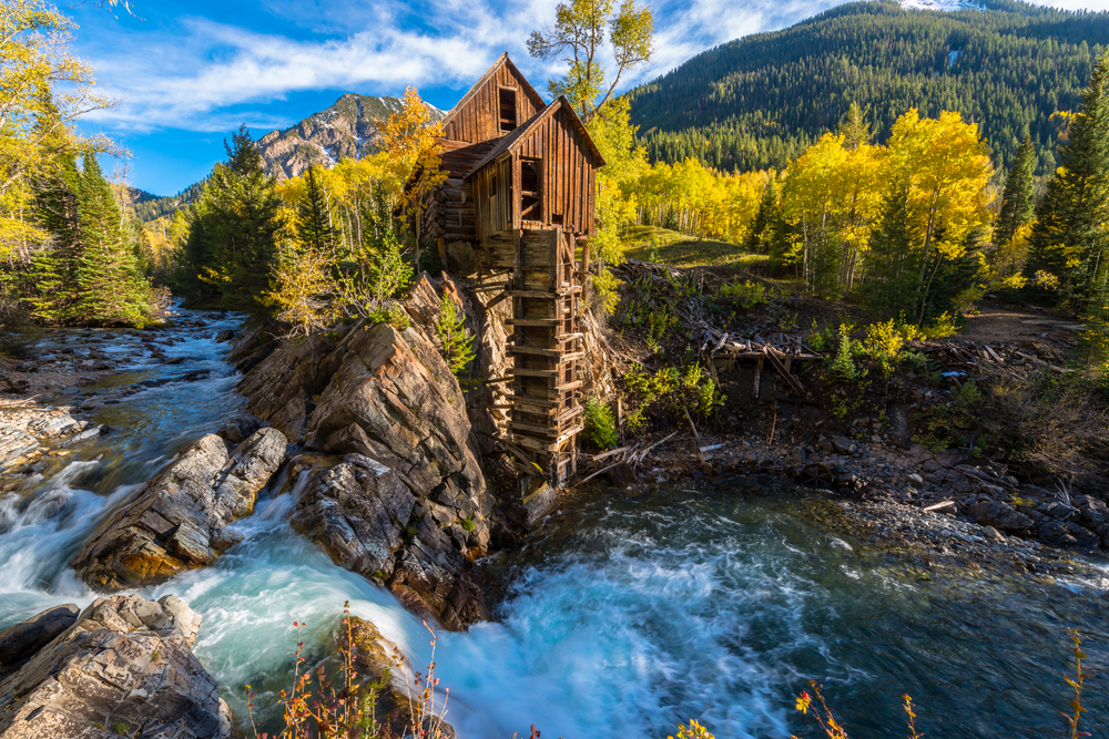
The Crystal Mill
This popular Colorado hiking destination will take you to the haunting remnants of an old mining city’s past and surrounded by one of the most enchanting panoramic landscapes. Located within the White River National Forest, this hiking route follows the same path paved by miners over 100 years ago.
Unanimously referred to as the “Crystal Mill” or the “Old Mill” today, the former Sheep Mountain Power House was a compressor station built in 1892 to power the machinery that constructed the Sheep Mountain Tunnel.
The Old Mill itself is located on a small outcrop next to the Crystal River Creek that falls into a shallow basin beneath the wooden structure. Once a testament of humankind’s ability to commandeer nature’s power, the ageing mill has since been encroached on by nature herself. The mill is a romantic reminder of the old world, although it’s a very familiar story that’s been echoed throughout the Colorado wilderness.
Ready to hike to the Crystal Mill? Take the Schofield Pass from the Town of Crystal (a 2-mile paved road) or begin your trek farther out on the same road from the town of Marble, located only 9 miles from the Mill. Accommodation is easier to come by here, and the drive/hike is scenic with fantastic views of the Whitehouse and Sheep mountains.
These roads see plenty of car, foot, bike, and UTV traffic year-round. Unless you have a 4×4 with proper experience, we don’t suggest driving from the city of Crystal to the Old Mill. Not only are the views just more gorgeous on foot, but the level of traffic on the the narrow unpaved roads, combined with the road conditions makes driving dangerous to passengers and hikers alike.
Once you arrive to the Mills’ parking lot, you’ll be able to see the old power house in full view! Snap some pictures before exploring the area via the multiple trails available from this trailhead, or get closer to the creek for $10 a piece! Come and see why the Crystal Mill is one of the most scenic hikes in Colorado!
Conundrum Hot Springs
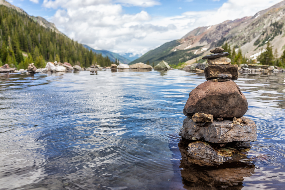
As the most popular primitive hot spring location in Colorado, the Conundrum Hot Springs must be hiked at least once in a lifetime! Located off the Conundrum Creek Trail, this 18-mile (roundtrip) hike is longer, but well worth the effort! For this reason, many hikers purchase a permit to camp in the Conundrum Creek Valley between the Silver Dollar Pass and the Triangle Pass.
This trail is of moderate difficulty, beginning with a mild grade trek though meadows with gorgeous snow-capped mountains in the distance. You’ll have passed three creeks before reaching the eight-mile mark where you’ll find a sign directing hikers to campsites. From here, the springs are fairly easy to find!
You won’t at all regret having come all the way when you arrive to find a group of hot springs off the trail. At 11,200 feet in elevation, they average a temperature of 102 degrees Fahrenheit. One hot spring is so large that it fits a party of 15! Sit back and enjoy the most spectacular views of the Maroon Bells-Snowmass Wilderness all around you.
Check out more amazing hot springs in the USA!
Garden of the Gods
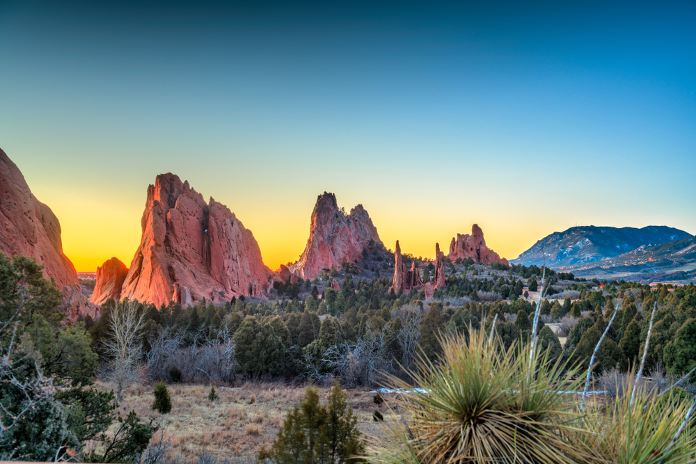
Located in Colorado Springs, the Garden of the Gods is a relatively short hike in Colorado that’s great for families and any skill level. The National Natural Landmarks began forming millions of years ago as sediment on the bottom of an ancient sea. It is truly one of the best weekend trips from Denver so if you are in the area, you will want to do this hike!
Over time, the hardened seabed formed red and white sandstone which and underwent the same geological forces that created the Rocky mountains before eroding into the peaks and shapes that we see today. These formations have been brought to life with with the cleaver names and each have their own individual stories.
The history of humans in the Garden of the Gods also reaches far back, with tribes like the Apache, Cheyenne, Comanche, Kiowa, Pawnee and Ute all claiming an ancestral connection to it. In particular, early Ute petroglyphs dating dating as far back as 1330 BC tell creation stories to the people who would have camped amongst the red sandstone figures. A well entertained destination in the past, the Garden of the Gods is property of the City of Colorado Springs, and remains free to enter!
Although free to explore by foot and car, a slew of guided and alternative tours, be it jeep tours, segway tours or horseback tours, are offered as well. The park has both paved and dirt trails, but most attractions are visible from the paved road, which can be driven in about 20 minutes.
For anyone interested in hiking, begin at the Trading Post. It houses a large shop, a restaurant overlooking an amazing view from its patio, park information, bathrooms and even a Starbucks. To get some insight into the history of the park and individual formations, consider taking a free 30-minute guided tour, available between 10am and 2pm every day.
Bridal Veil Creek Trail
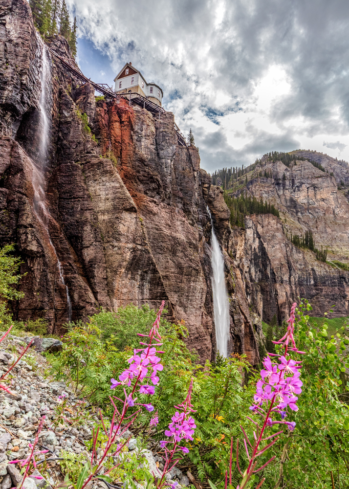
The 4.8-mile Bridal Veil Creek trail near Telluride, Colorado is hiked primarily for it’s namesake waterfall at the trail’s end, though the moderate hike features a few bonus waterfalls under its forest cover!
Beginning on the east end of Telluride, this hike snakes its way up to the base of the iconic Bridal Veil Falls – the tallest free-falling waterfall in the state that falls over 365 feet over the Box Canyon. Above the falls, on the 400-foot cliff is a hydroelectric plant dating to 1907, which to this day continues to provide the city with a fourth of its energy to date. Because of this plant, hikers are not allowed to climb the falls. Luckily, the best view of Bridal Falls is truly from its feet!
The Bridal Creek Trail itself only recently opened with the purpose of entertaining hikers with an alternative route less dangerous than the traditional route, a steep 4×4 road that’s become congested with heavy road traffic in recent years. Many hikers still enjoy hiking this route for the city views on the way down, but preferring the safer and shadier alternative on the climb up to the Falls. This hike has quickly become one of the most popular hikes on Colorado!
Hanging Lake
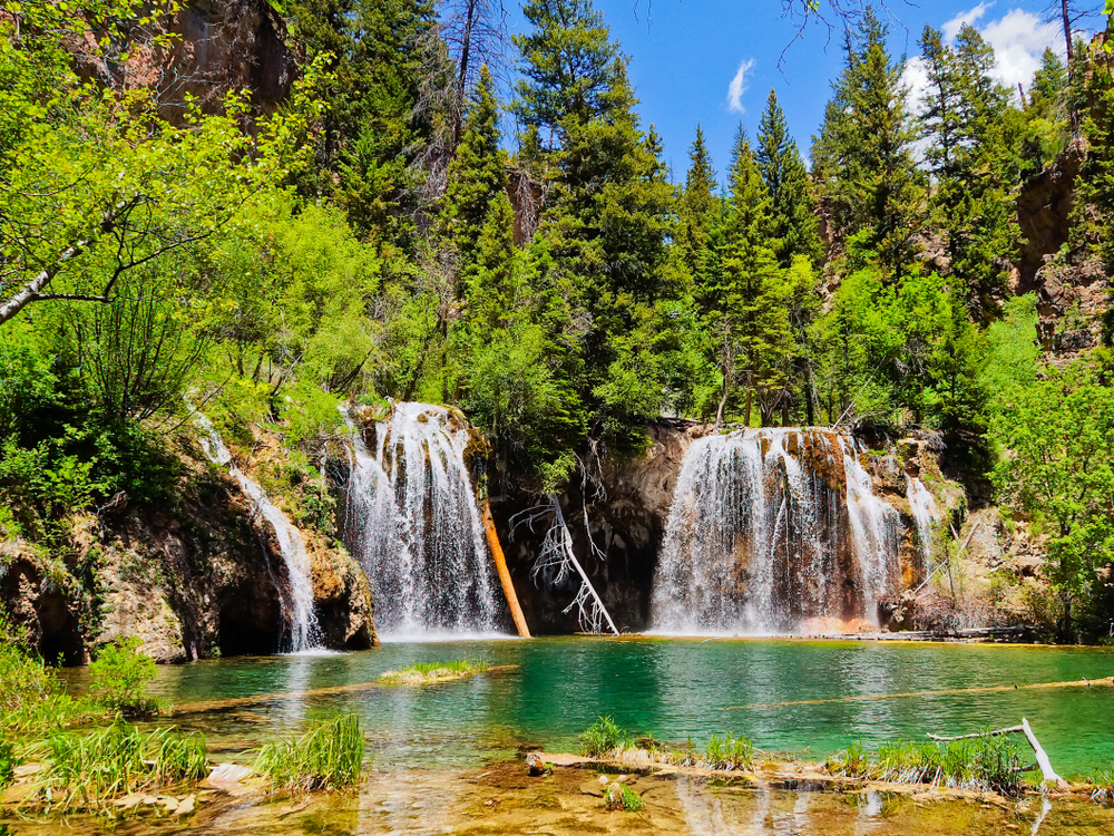
Located inside the White River National Forest just 7 mi east of Glenwood Springs, the Hanging Lake is but one of the many beautiful lakes in a deep canyon carved by the Colorado river. It’s also one of the most scenic hikes in Colorado!
This idyllic lake has bright green water and gentle streams of water flowing into it. The source water lake was created by a geologic fault the caused the lake bed to drop from the floor above, and is today one of the best examples of a hanging garden plant communities. Considered to have one of the purest water sources in the world, it’s a sacred space of mythological origin for the Ute tribe, and feeds into the Bridal Veil Falls nearby.
While the the mile-long path is difficult and steep to hike, it’s relatively short, and absolutely beautiful. There’s of course no swimming allowed in the hanging lake, but that’s why it’s so majestic and vibrant today! Because the lake’s ecosystem is incredibly fragile it’s accessible only by a viewing platform.
The Hanging Lake Trailhead begins at the Hanging Lake Rest area in the Glenwood Canyon and is accessible by car, foot or bike. Permits to enter the trailhead will cost $12 a person, whether or not you choose to park. These funds will be put towards the conservation of this beautiful and to the educational and reservation services offered for this trail.
Royal Arch Trail
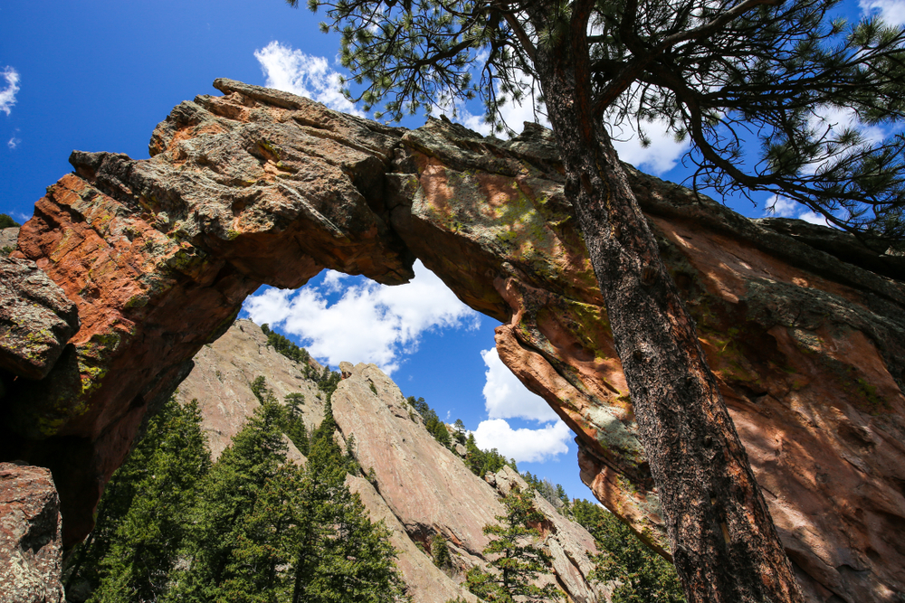
This difficult yet short 4-mile hike in Colorado has an incline of over 1,400 feet and is located inside the Bluebell Canyon in Chautauqua Park. The trail’s final destination, the Royal Arch, is a large geological wonder. You’ll be able to walk through and all the way around arch, and view the entirety of Boulder below with it’s unique flatiron and valleyed landscape.
The trail is complete with fantastic rock formations and views of the valley below. Beginning your hike, you’ll descend into the Bluebell Canyon itself before beginning the climb. The trek is otherwise a steep and strenuous one, as most of the hike is a staired. It doesn’t let up until the very end!
To get to the Royal Arch Trail trailhead, first find the Chautauqua Park Trailhead and take the Bluebell Road Trail to the Bluebell Shelter. From here, you’ll find signage pointing you towards the Royal Arch. The best tip for this hike is to hike the trail during the week, and in the morning, as it’s known for its terrible congestion, mostly due to the fact that it’s so accessible from Boulder.
Mayflower Gulch
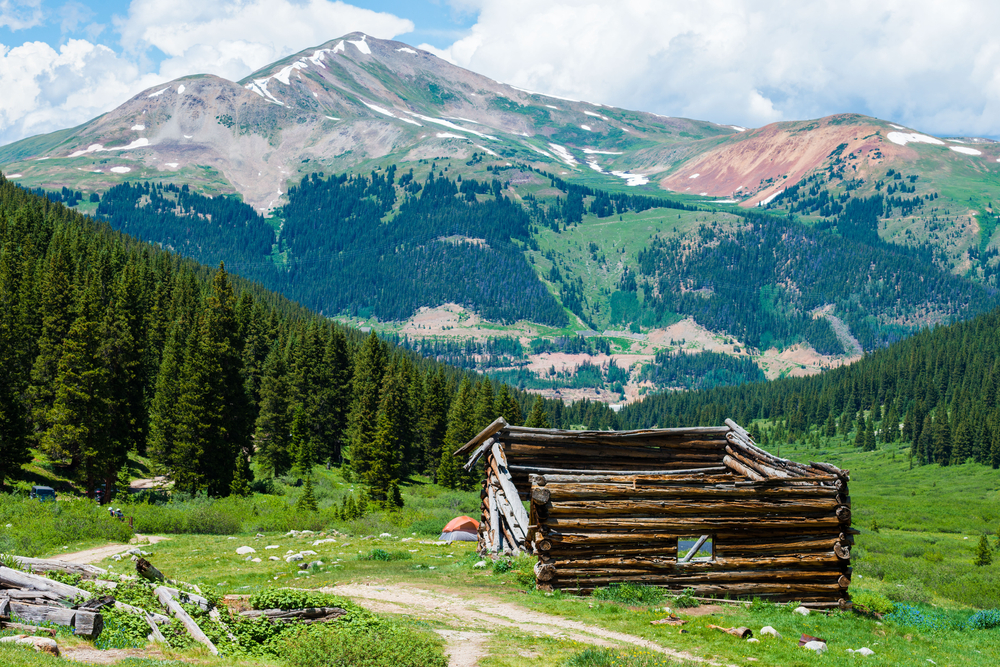
A popular 6-mile back trail in Colorado’s White River National Forest, the Mayflower Gulch Trail is relatively easy and refreshing hike year-round. While brimming of wildflowers in the summer, the gulch is a playground for cross-country skiers and snowshoes during the winter. This large basin itself was formed from millions of years of erosion, but owes most of its dramatic backdrop to the hight of the sawtoothed mountains surrounding it.
The Mayflower Gulch Trail consists of forest paths that stretch into creeks and riverine terrain, a scene of scattered old mining buildings, amazing vistas of snowy peaks, and picturesque pinewood forests. If you can’t get enough of this scenery, you won’t want to stop before climbing further! Take the trail to the right, and ascend uphill towards the edge of the basin where you’ll be able to capture the most amazing panoramic views of the gulch. Just be prepared for the change in weather, and bring appropriate gear on your hike.
Don’t forget to explore the old mine ruins hidden along the Mayflower Gulch Trail. It will be off the fork that otherwise ascends the side of the basin. Although no signage offers any clue about what might be just off the trail, the decaying mining complex here is one of the most novel parts of the hike. For the best experience, arrive early in the morning when the trail is most serene, and explore the space at your own pace!
Mount Sniktau
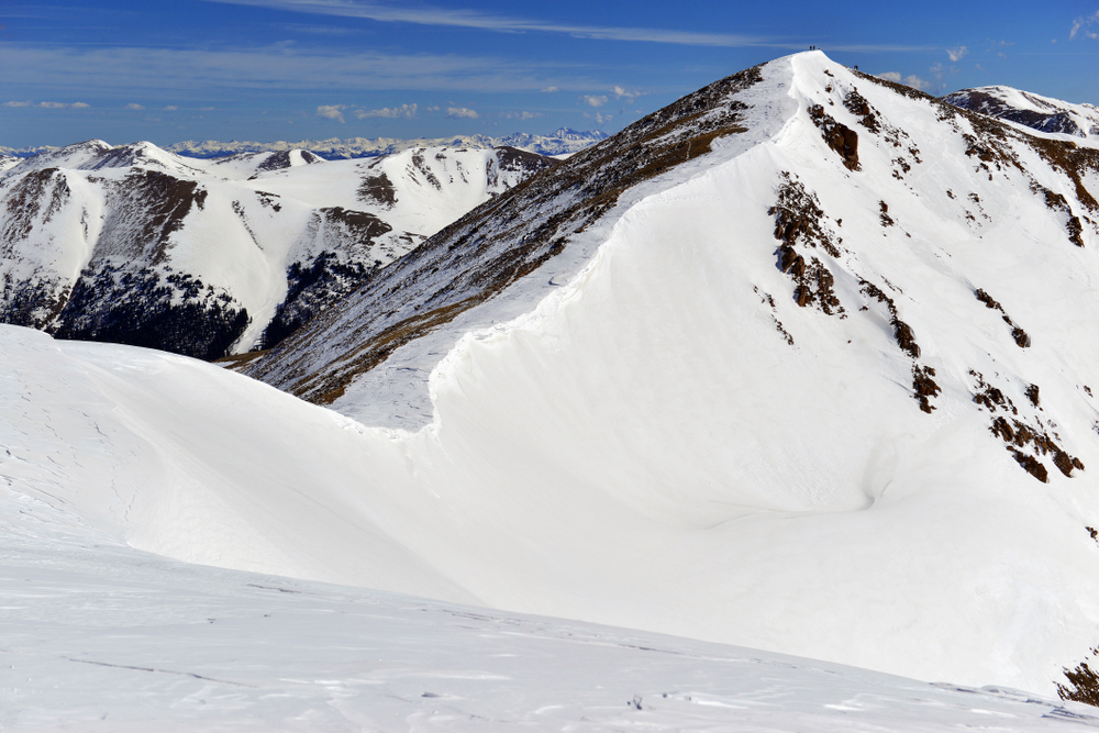
The Sniktau Mountain Trail, a 4-mile hiking trail in the Arapaho National Forest, is one of the most manageable, and one of the most stunning “13er” summit hikes in Colorado. Located just an hour outside of Denver, this hike is accessible to the densest population in the state, and is therefore extremely popular. A great introduction to summit climbs, this trail is often used as a warm-up to more difficult 13 or 14 hikes later in a season, or as a first in a career of many more to come.
This hike is a difficult trek, climbing over 1,500 feet over 2 miles to a total elevation of 13,000 feet. The trail will take an average of 2-3 hours to complete, assuming the weather is manageable. The first mile is particularly steep and can be difficult on the lungs if you’re not accustomed to the elevation, so take your time ascending this first part.
Leveling out atop the ridge of the peaks, the hike will becomes less demanding and more panoramic. While this may be view enough for some hikers before descending, others will take a left at the fork towards Cupid and Grizzly Peaks. Taking a right will bring you towards Mount Sniktau. A little over a mile and a second climb later after you’ll have reached the tallest point of your hike to the summit! The views are astounding, with beautiful alpine lakes in one direction, and endless views of mountains in another!
This hiking trail is easily accessible off the highway at Loveland Pass, though be prepared for a full parking lot. Because Loveland Pass is a popular vantage point the lot may fill quickly.
Due to the steepness of the trail, the change in weather as you climb, and the sometimes slippery surface of the loose rocky surfaces on this trail, don’t forget to prepare thoroughly for extreme conditions, plan ahead and pack accordingly. Layers, micro spikes and poles are a must for Lake Sniktau!
Radium Hot Spring
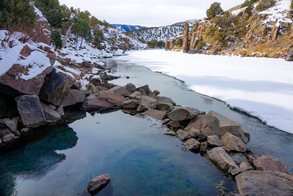
The Radium Hot Spring is an intimate little hot spring situated next to the Colorado river. Imagine soaking in a warm pool surrounded by the best elements of nature and listening to the rush of the river. This location is also renowned as a destination for hiking, kayaking, tubing, cliff jumping, and camping! But unlike the others, this little soaking spot is available year-round!
Located three-quarters of a mile from the Mugrage Campground in the Radium State Wildlife Area, the spring will takes around 20 minutes to reach once you leave your car. Due to the lack of cell service out in this area, all hikers are recommended to bring along a downloaded map on your phone (or a paper map), and to trace their tracks as carefully.
The short hike begins with a sharp incline, flattening out as you approach the Colorado River. The trail will end at the cliffside above the river and the hot spring will be nestled up against the cliffside. The hiking trail itself is somewhat ambiguous without signs, but the Springs’ popularity has made the sport of finding it a little easier.
To reach the hot spring, you’ll have to climb down that 60-foot rock face via large boulders next to the river, or approach the hot spring via kayak from the river. Please plan your trip accordingly! Bring your swimming suit on your person (as you’re likely to run into other campers and hikers), some good climbing shoes, and plenty of hydration!
The Incline in Colorado Springs
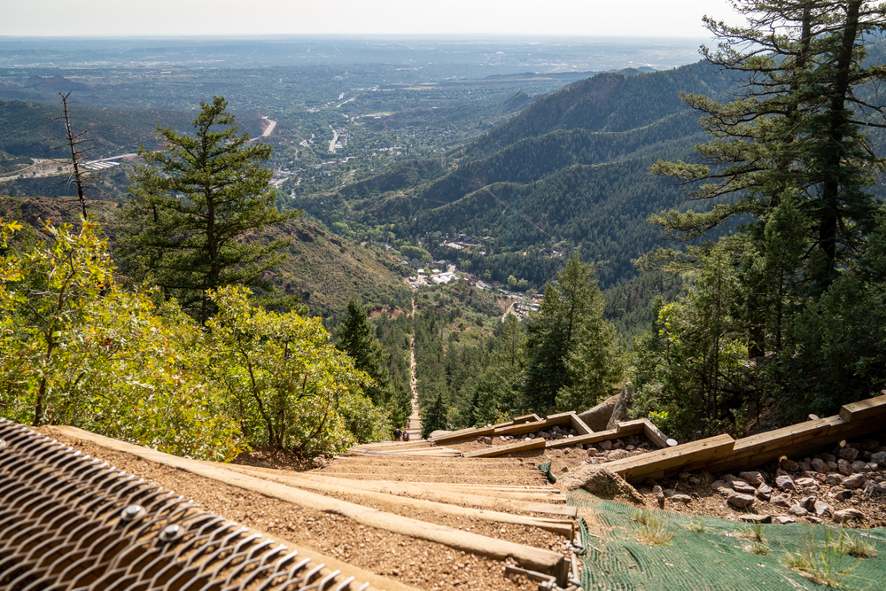
If you’re coming to Colorado for a challenge, nothing can to compare to The Incline in Colorado Springs! A top destination for all of the cardio junkies out there, this advanced hike flanks the eastern face of Plank’s Peak, has some 2,768 steps, an average grade of 45 percent, and an 68 percent incline at its most extreme.
The Incline attracts people from all over the country due to its uniqueness and difficulty, though we would only recommend the hike to anyone who is very physically active or an advanced hiker. The trail hiked up is not the same trail used to descend the mountain, and is therefore dangerous to stop once begun.
Originally built as a cable car to carry materials up to the top of Pike’s Peak for pipeline construction, the cable mechanism was subsequently transformed into a cable car attraction for tourists and called the “Manitou Springs Incline”. When a rockslide irreparably damaged the attraction in 1990, and the Manitou Springs Incline fell into disrepair and the rails were removed.
The mountainside was then only climbed by locals until it was re-outfitted and re-marketed in 2013 as The Incline that we know today. The destination has quickly become one of the most well-known hikes in Colorado!
The 2000-ft, one-mile hike takes an 30-60 minutes to climb, depending on the climbers experience. Another 30 minutes will be spent descending via the 3-mile-long Barr trail, located 3/4 from the Incline’s summit.
The Incline is open from 6am-6pm, though climbers will need to make a free reservation to climb during covid times. Reservations are made available for 35 people in 30 minute intervals, and can be made at www.coloradosprings.gov/incline.
Lake Isabelle
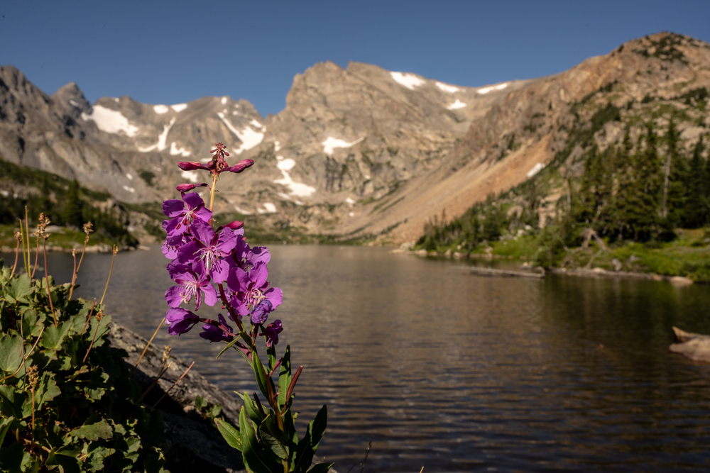
Located next to the small town of Ward, Lake Isabelle is an alpine lake found in the Indian Peaks Wilderness with a great mountain and forest views. The 7-mile hike has a moderate incline of 3532 feet, and like most hikes in Colorado, is just as stunning as the lake itself with a bonus lakes on the way, streams, pine forests and even moose!
The hike to Lake Isabelle begins on the Long Lake Trailhead in the Brainard Lake Recreation Area. A short distance from the trailhead, you’ll enter into the Indian Peaks wilderness, a 76,00 acre mountainous territory north of the Rocky Mountain National Park.
Passing Long Lake, the large glowing alpine body of water with a thick coniferous canopy surrounding it, you’ll continue westward via the Pawnee Pass Trail towards Lake Isabelle. This area between these lakes is a prime habitat for moose. Gradually gaining elevation, you’ll pass the tree line and be faced with only the mountains ahead of you. The end of the Pawnee Pass circles to the north-side of Lake Isablle, beholding one of the most peaceful clear-water lake you’ll ever behold.
The lake is framed by the Niwor Ridge, and the 13ers Navajo, Apache and Shoshoni Peaks. To get to the lake itself, you may have to take off-trails leading down, and struggle over some rock outcrops, but the lake’s views do not disappoint!
Before planning your escape to Lake Isabelle, insure you’re arriving between Mid-June to Mid-October, when the service station on Brainard Lake Road leading to the trailhead area is open. Don’t forget to arrive early so as to snag a spot in the parking lot while they last!
Emerald Lake Trail
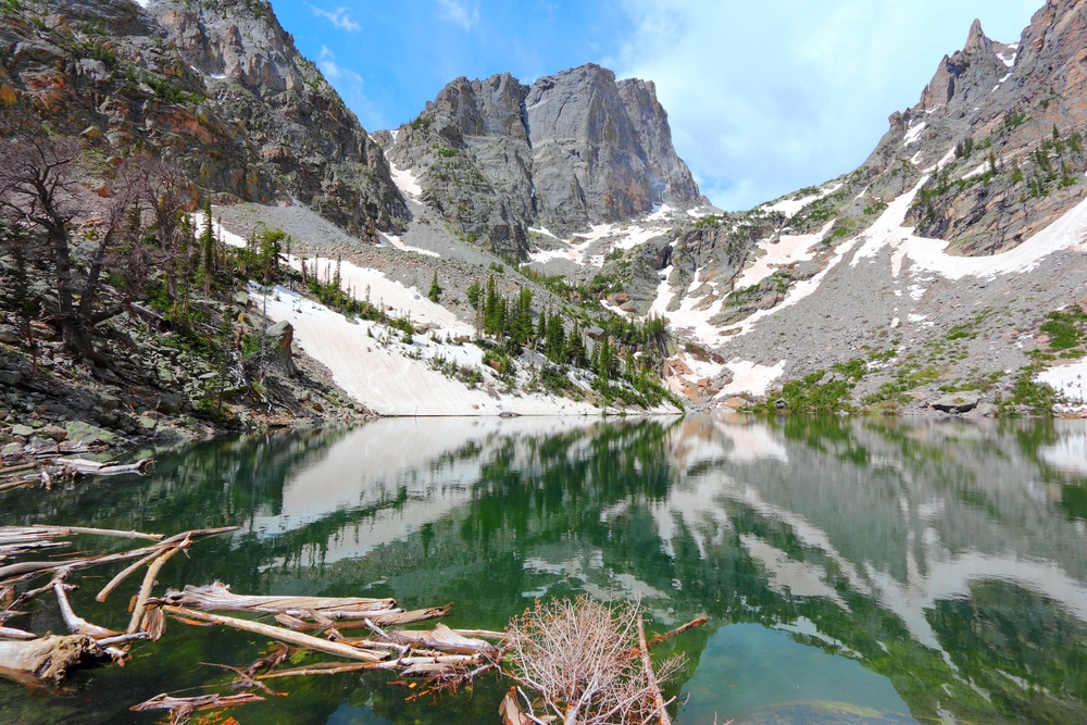
Located near Estes Park, the Emerald Lake Trail is a 3.3-mile trail in the Rocky Mountain National Park that’s easy to experience and open all year long! Less than 2 miles from the trailhead, Emerald lake bears views of 2 dominating mountains, and a gorgeous waterfall at the lake’s end.
The beginning of the Emerald Lake Trail breaks off from the popular Bear Lake loop, which can be covered at the beginning of an early morning’s hike before the loop around this subalpine lake becomes too crowded. You’ll then continue past the Emerald Lake trailhead, where you’ll begin your forest-covered ascent to Nymph Lake. Slowly, Hallett Peak becomes more visible until it’s completely unobstructed in view behind Nymph Lake. The trail between this lake and Dream Lake will be one surrounded by wildflowers when in bloom, and an even prettier view of the mountain and alpine-framed Dream Lake.
Following a gorge, a final ascent of steep alpine forest, and a full-blown, unobstructed view of the jagged spires of Flattop Mountain, you’ll find Emerald Lake before you. As its name suggests, the lake’s emerald color practically glows from within it’s mountainous entrenchment. The colorful growth around the lake stands in great contrast to the jagged spires of Flattop and Hallat Peaks above it. Perfect for families and solo hikers alike, this scenic trail is one of our favorite hikes in Colorado!
Ice Lake Trail in the San Juan Mountains
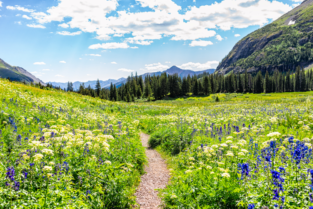
The popular 9.5-mile Ice Lakes Basin Trail near Ophir, Colorado is renowned for it’s stunning wildflower landscapes, it’s creeks and valleys, electric-blue lakes, and of course it’s magnificent mountains! Without a doubt one of the most scenic hikes in Colorado, the upper portion of the loop-trail puts hikers onto the peaks of these very mountains, where views are unobstructed by forest. For it’s variety and consistency, Ice Lake trail is one of the most stunning hikes in Colorado!
Beginning at South Mineral Campground in the San Juan National Forest’s South Mineral Valley, the trail’s initial mountain overview will turn into a thick conifer forest as you move north through the loop trail. You’ll pass through forest, meadow and creek with considerable elevation gains until the forest line disappears entirely, at which point you’ll have entered the Lower Ice Lake Basin.
From here on, you’ll be fully exposed to the wind and sun. The deeper you trek into the basin, the more scenic the landscape becomes! At 3.5 miles, you’ll have caught sight of the cobalt-blue Ice Lake, surrounded by wildflowers as far as the eye can see. It’s ramparted by the Fuller, Vermillion, Golden Horn, and Pilot Knob Mountain Peaks!
But don’t stop at Ice Lake if you don’t want to! The same trail has access to Lake Island and Fuller Lake, and while they are more difficult, they’re less frequently visited, and all the more beautiful for it. The full “loop” is considered a challenging trail, requiring some skill, adrenaline, and appropriate trail gear (especially around Island Lake) because of its narrow trails. Prepare for this hike by bringing spiked shoes, trekking poles, and layers for the unpredictable weather above the tree line.
Please keeping mind that new permit system has started being enforced to protect the quality of the trail, the tundra ecosystem and the beautiful lakes coveted on this hike. Don’t forget to obtain a permit from the Columbine Ranger District before heading out the the trailhead!
Maroon Lake
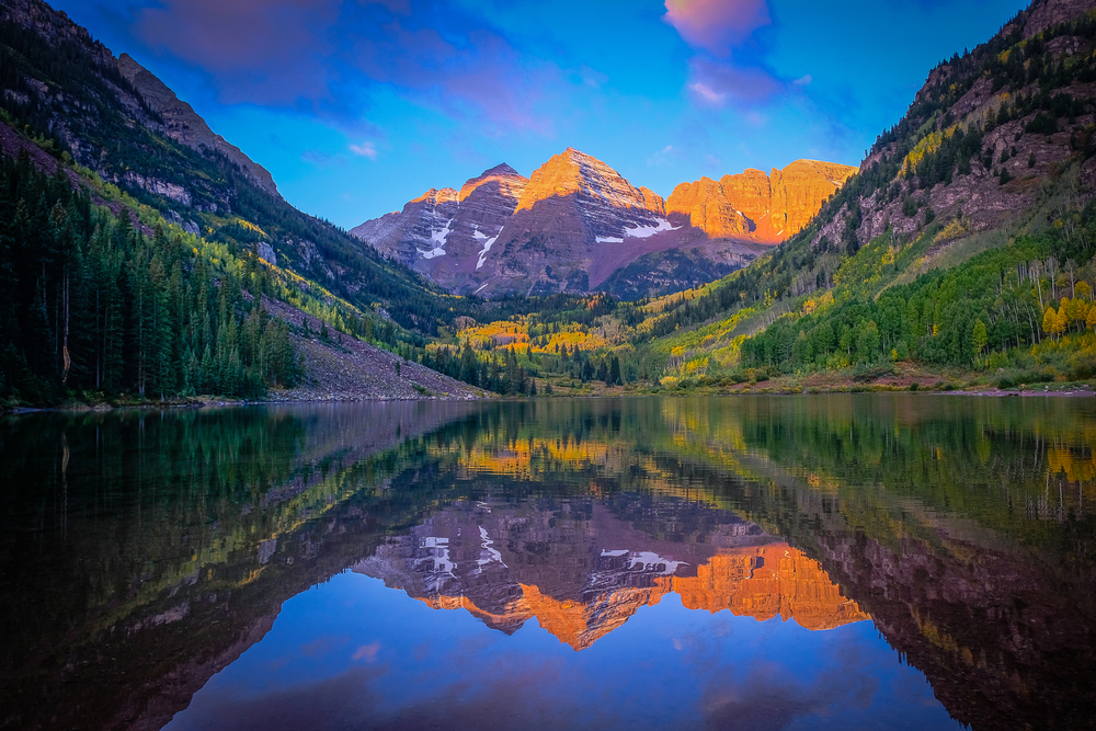
Maroon lake is one of the most accessible hikes in Colorado on our list, being just steps away from the Maroon Lake Scenic Area’s designated parking, and only 20 minutes outside of Aspen. While the lake doesn’t need to be hiked to reach, the Maroon Lake Traill merges into the Maroon Creek Trail (also known as the Crater Lake trail), a path that connects the two mountain lakes to one another. The relatively easy 2- mile hike has extraordinary views, and is perfect for families, day picnics, and photographers!
Pinkish in hue, Maroon Lake and its Mountain backdrop showcases the Rocky Mountains at their most beautiful. The lake’s mountain backdrop includes the famous Maroon Bells (both 14ers), both with a unique pattern and pigmentation that comes from the valley’s unique sedimentation, and millions of years of glaciation. Due to their high nutrient levels and algae, Maroon and Crater Lake are green in color and maintain very successful fish populations. The lakes are also known for reflecting their stunning mountain scapes over their surface when calm – a photographers’ dreamscape!
While Maroon Lake is sufficiently worth the trek within itself, those who choose to hike to Crater Lake will be rewarded with a hike that embraces the even larger Maroon Bells towering above it. The hike takes you through a dense aspen forest brimming with wildlife!
Interested in camping? Silver Bell Campground offers 14 sites with panoramas of the valley!
Longs Peak
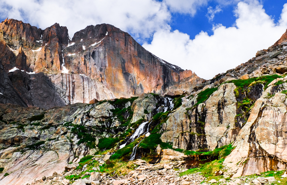
Of our hikes in Colorado, Longs Peak is a climb recommended only for the most advanced of hikers. Much more than your typical hike, this trek involves a 5,039 elevation gain over a span of almost 15 miles, and a variety of mountain terrains that require multiple skillsets and abilities from the hiker. This trail isn’t for the faint of heart, though it’s certainly the penultimate Colorado hiking experience.
Climbed mid to late summer when the hiking the route becomes feasible without equipment, hikers will be expected to scramble over rocks, navigate changing weather and environments, and have the endurance to climb a handful of different mountainous terrains. When faced with the opportunity, some hikers will choose to boulder and climb as well.
The hike begins with a 6-mile flat trail to the base of Longs Peak. The approach of the boulder field, called the “keyhole,” is a narrow passage through the mountain face that requires some scrambling and climbing. From here, a mile and a half of mountain terrains will be crossed, including ledges, rims and troughs. Finally, the final stretch of the mountain trail is spent slowly and carefully descending the mountain.
Before attempting LongsPeak make sure to train and prepare thoroughly before jumping in. The biggest concern for any hikers in exhaustion, altitude sickness and dehydration. Thoroughly study the environment and possible weather on the mountain before hiking, continue to watch out for any trail updates on the trail and enjoy the challenge! The Peaks Pike trail is certainly one of the most memorable hikes in Colorado!
Great Dunes Nationals Park
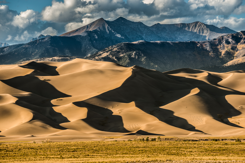
Truly one of the most diverse landscapes in the United States, Colorado is also home to the tallest dunes in North America! Some of the most unique and stunning hikes in Colorado are found here in the Great Sand Dunes National Park. Beyond its spectacular 750-foot sand dunes, the park also offers forest-covered nature trails, creeks and meadows, a campground, 4×4 primitive roads, and countless viewpoints overlooking the dunes’ mountain backdrops.
The most exciting facet of exploring the Great Sand Dune National Park is walking and sliding down the sandy ridges of the dunes themselves. The question then becomes – how many ways are there to experience this natural wonder? Most visitors will hike the First Ridge, a popularly photographed, off- trail hike with views of the entire dune field. Hike in the morning, or just at day-break for the best temperatures and lighting. We also highly recommend bringing or renting sand sleds or sand boards. This is the proper way to enjoy sand dunes.
Conversely, hikers can come at night and experience some of the best natural lights expose the dune’s curves and dives. The night sky doesn’t get much clearer than it does over the sand dunes in Colorado. Depending on the time of year, you’ll also be able to take advantage of seasonal experiences in the Great Sand Dune National Park.
Meadow Creek, accessible from the Dunes parking lot, is a wide stream with a powerful surge, the result of snow run off during winter months. FromApril to June, the stream becomes a cool, refreshing juxtaposition to the dunes towering above it. During the winter, the snow falls on the dunes weekly, allowing hikers to don their skis, snowboards and their sleds, and enjoy the steep inclines in winter gear.
Interested in exploring off the path? With a backpacking permit you’ll be able to hike off-trail deeper into the dune field. The most popular trek is to the Star Dune, the tallest dune in the park at 750 feet from its base to peak. Backpacking and camping permits can be purchased for the Sand Dunes National Park online.
Home to a diverse landscape of mountains, grasslands, wetlands, tundra, and desert, Colorado is a jewel of the very best kind that offers something new at every turn. The hikes in Colorado are humbling experiences that will forever change the way you look at the world around you. That being said, we highly urge all hikers to prepare to leave no trace behind and to plan thourouly for before hitting the trail. It’s equally important to keep in mind that trails change constantly. Before settling off, visit your trail’s website, train for and research your hikes. And of course, keep an eye out for any sudden closures, warnings, or weather risks in your area. Stay safe and enjoy these inspiring and scenic hikes in Colorado!

 Best Views In Samuel H Boardman State Park